Image

Geopotential height of the SH polar vortex has Positive correlation with the AAO

An incredible correlation between vertical geopotential height and the phase of the AAO.

Amazing l have never noted that before. A light bulb moment.

When geopotential height between surface to 100 hPa is positive . The AAO index is negative.
When geopotential height between surface and 100 hPa is negative. The AAO index is positive.

Some convincing proof that the condition of the polar vortex affects our weather.
I will put this geopotential height anomaly in the polar vortex on my weekly observation  round.

https://www.cpc.ncep.noaa.gov/products/precip/CWlink/daily_ao_index/hgt.aao.shtml

timeseries june to sept pv geoht

Image

2018/19 : the second-warmest financial year on record in Australia

Climate of the 2018–19 financial year ..Report by BOM

http://www.bom.gov.au/climate/updates/articles/a034.shtml2018–19 financial year

‘…it was the second-warmest financial year on record’

……

.My comment… Since when are ‘financial years’ the  time frame for the primary seasonal report?


Image

Stratospheric warming and a central polar vortex split in the Southern Hemisphere 2019

source

https://www.cpc.ncep.noaa.gov/products/intraseasonal

The above animation shows 2 warmings spots .. (edit.. sorry ONE warming spot , movinv west to east)at about latitude 60s commencing the first week of June 2019 .

They appear to be fully formed a few weeks later in the last week of June. The week of this post.

The AAO was positive during the month of June 2019 but is forecast by half the ensemble models to go strongly negative in the coming weeks.

I am not sure of the link between the Stratosphere warming and the AAO but will be on the look out.

—————–

This post is in progress. Check the comments section below for further entries. Click on the title of this post to load further information if necessary

Image

AAO correlated with southern hemisphere synoptic 2019

Here l take snaps of the ACCESS g model southern hemisphere synoptic and also record the AAO/SAM parameter.

Looking for synoptic patterns and if they correlate with shifts in the AAO. I will make a few observation notes as warranted.

AAO link.

https://www.cpc.ncep.noaa.gov/products/precip/CWlink/daily_ao_index/aao/aao_index.html

ACC g  southern hemisphere synoptic

http://www.bom.gov.au/australia/charts/viewer/index.shtml?type=mslp-precip&tz=AEDT&area=SH&model=G&chartSubmit=Refresh+View

The first entry is below and then scroll down to comments section for all further additions. Click on the heading to load if necessary

5th may 2019 _AAO

image below 8th may 2019  AAO  going strong positive  Here +0.7 and going up

8th may 2019 polar low displaces cold air _SH

11th may 2019 aao vs SH synoptic

Image

2019 SNOW Australia

There had been a couple of early snow falls as the AAO dropped strongly negative in late February,  the jetstream meandered and the westerly belt brought bursts of cold air onto Tasmania and southern alps

A short period of +AAO in early March and then another steep drop in the AAO , not as steep. Down to neutral. A week later and we have another. old pool being cut off to affect Victoria and the NSW alpine districts 30th March and 1st April.

Link for AAO/SAM

https://www.cpc.ncep.noaa.gov/products/precip/CWlink/ENSO/verf/new.aao.shtml

30th March 2019. Here is the thickness forecast showing 536 thickness over the Ballarat ranges initially. The cold pool then to combine with a surface trough over Alpine regionssnow 30th March 2019http://www.bom.gov.au/australia/charts/viewer/index.shtml?type=mslp-thick&tz=AEDT&area=Au&model=CG&chartSubmit=Refresh+View

mount baw baw 30_3_2019

Also snow on alps in NSW and inland NSW

Rob G.We’re at 1260m. Snow shower started with big wet flakes, then small hail. A few small flakes falling now.
stoxxo..Also snowing at Edith south of Oberon at about 1190m, impressive for March!
waveridee..Ditto Black Springs apparently.

Adaminaby Angler Loc: Anglers Reach NSW; 1,290 m  Was most certainly snowing down here, I can tell you that! Lovely, fat flakes indeed. laugh Was out & about driving much of the day; overseeing the yonder snow-laden alps.

However, what shocked me the most was getting the call from my relative at Black Springs-Shooters Hill (who owns the property there—precisely where I was for much of last year at 1,277 m AMSL); snowing up North too!

Never have thought the snow would fall so far northerly this time of year…absolutely unusual. Something tells me this upcoming snow season might be one for the books. smirk

Gotta love the contrast from January til’ now!

http://forum.weatherzone.com.au/ubbthreads.php/topics/1496752/Re_NSW_Day_to_Day_Weather_2019#Post1496752

another forum thread snow 2019.

http://forum.weatherzone.com.au/ubbthreads.php/topics/1496834/Re_2019_Australian_Snow_Season#Post1496834

Eigerwand“Well this appears to have been a pretty good little to whet the appetite for the season ahead. Saw some footage on Snowsearch from Perisher this morning, enough snow to make everything white 🤩

Rsav”Today I took the chairlift from Thredbo up to Eagles Nest and walked as far as Mt Kosciuszko Lookout. A winter wonderland up on top, quite a sight for so early in the year.”

FOR ALL SNOW REPORTS FROM APRIL ONWARD SCROLL DOWN TO COMMENTS SECTION WHERE L WILL POST.

Click on the Title if the comments need loading. Please feel free to comment or add to the information

Image

A study of cold fronts in Australia

I will collect information and observations

2019

Forecast for 532 thickness for Tasmania 6 days into Autumn. which can bring low level snow

low level snow tasmania 6th march 2019

dynamic jetstream AAO negative 4_3_2019

ABOVE

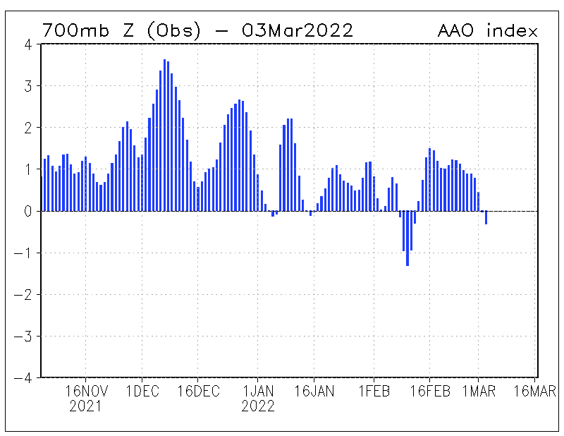
Nothing like a wavy sub polar jet associated with a negative dip in the AAO/ SAM since —early February 2019, to produce dynamic wavy jetstreams at the 200hpa stratosphere.

and satellite picture BELOW ……………………….

is the cold pool in the Bight 5th March 2019. The day before it travails over Tasmania.

The cold pool sits within the bulge of the sub polar jet but at the surface layer

The cold air is transported north into NSW  by the southern  and eastern flank of the

Mid -latitude High

5_3_2019. cold pool ijn the bight

SOURCE. BOM

http://www.bom.gov.au/australia/charts/viewer/index.shtml?type=mslp-thick&tz=AEDT&area=Au&model=CG&chartSubmit=Refresh+View

__________________________________________________________

Temperatures got down to 9.8 deg in Hobart and light splatter of snow on Mount Wellington

Mount Baw baw in Gippsland Victoria also had a light dusting of snow with temps down to 0 deg c for most of the day

NEWS article

Mount Mawson 6th March 2019

quote from Ben ” 6th March 2019

Today’s taste of wintry weather comes less than a week after the state endured a day of record-breaking March heat.

Dover’s 40.1 degrees on Sunday was the first time on record any location in Tasmania has exceeded 40 degrees during March.

Eight other weather stations, including Hobart (39.1C), also beat Tasmania’s previous March maximum temperature record of 38.0 degrees on Sunday.

Impressively, Hobart’s 39.1 degrees on Sunday was also hotter than any day in the city during summer. Last season’s highest temperature was 37.9 degrees.

Sunday’s heat now seems like a distant memory, as much colder southwesterly winds flow over the state today.

Hobart was only sitting on 13 degrees at 10am, although wind chill was making it feel more like eight degrees.”

Image

A study of significant heat or drought in Australia

I will just collect information and post links.

IN PROGRESS,..

SUMMER 2018/2019

A persistent pos AAO…Stalled synoptic pattern…with the Tasman high centred west of NZ..,.. jetstreams well south and zonal ( not wavy).. monsoonal activity mainly up in the far nth qld

map source:

http://www.bom.gov.au/jsp/awap/rain/index.jsp?colour=colour&time=latest&step=0&map=decile&period=3month&area=nat

Three-monthly rainfall deciles for Australia

Comments and information from weatherzone forum  >>>>>>>>

Rainfall deciles… Archive …. Australia.

http://www.bom.gov.au/jsp/awap/rain/archive.jsp?colour=colour&map=decile&period=3month&area=nat&year=2014&month=2&day=28

TEMPERATE  ANOMALIES…. SUMMER of 2018/2019

KEN KATO..said  “Above is what Australia’s hottest summer on record looks like in the decile maps covering the last 3 months.”

http://forum.weatherzone.com.au/ubbthreads.php/topics/1492763/60

———————————————————————————————————————————–

Scroll down to the comments for all other entries

Click the heading of this post if the comments aren’t loaded


Image

Historical ..Annual_Seasonal _monthly climate reports for Australia

I will  give some links to these resources. On this front page and in the comments section below

IN PROGRESS

The Australian recent climate – news, reports and summaries

http://www.bom.gov.au/climate/current/

ARCHIVES

http://www.bom.gov.au/climate/current/statement_archives.shtml

—————————————————————————————————————————————–

2015-2016

Seasonal climate summary southern hemisphere (summer 2015-16):  strong El Niño peaks and begins to weaken
Acacia S. Pepler1  1 Bureau of Meteorology, Sydney, Australia

Click to access Seasonal2.pdf

2000

Seasonal climate summary southern hemisphere . Winter of 2000 ..

by    Grant Beard…A near neutral phase of  ENSO

http://www.bom.gov.au/jshess/docs/2001/beard_hres.pdf

Image

Flooding events in Australia

Not in  order of years but as l come across links and information


LINKS…..

Australia… record rainfall

http://www.bom.gov.au/water/designRainfalls/rainfallEvents/ausRecordRainfall.shtml

6 month rainfall anomalies. Archives. Australia

http://www.bom.gov.au/jsp/awap/rain/archive.jsp?colour=colour&map=anomaly&period=6month&area=nat&year=1983&month=9&day=30

Six-monthly rainfall anomalies for Australia

3 monthly rainfall deciles for Australia

http://www.bom.gov.au/jsp/awap/rain/index.jsp?colour=colour&time=latest&step=0&map=decile&period=3month&area=nat


Scroll down to the comments section for all further entries

Click the heading to load entries if necessary